Understanding the Importance of Fire Maps in Wildfire Management
Introduction
As wildfires continue to pose a significant threat to communities across Canada and globally, fire maps have become an essential tool for emergency management and public safety. These maps provide crucial information regarding fire-prone areas, aiding in preparedness, response, and recovery from wildfire incidents. Understanding the implications of fire maps is vital as it affects not only local communities but also the broader environmental landscape.
What is a Fire Map?
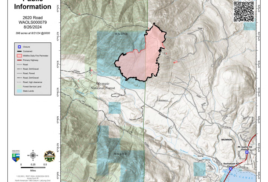
A fire map is a visual representation that displays information about wildfires and their potential spread. Utilizing satellite imagery, geographic information systems (GIS), and historical data, fire maps help delineate areas at risk of wildfires based on several factors, including vegetation type, weather conditions, and topography. They are frequently updated to reflect real-time data to aid firefighters and residents.
The Importance of Fire Maps
Fire maps play a critical role in wildfire management by:
- Enhancing Safety: By identifying areas at risk, fire maps inform residents about evacuation routes, safe zones, and regions to avoid during active firefighting efforts.
- Planning and Prevention: Authorities can assess fuel loads, identify vulnerable areas, and strategize controlled burns or mitigation efforts to minimize fire impact.
- Resource Allocation: Emergency management agencies utilize fire maps to allocate firefighting resources effectively to areas with the highest risks.
Current Events
Recently, regions in British Columbia have experienced significant wildfires, prompting an increased reliance on advanced fire mapping techniques. The province launched an updated fire mapping application that combines satellite data and weather forecasting to enhance situational awareness during fire events. This initiative allows residents to receive timely alerts and stay informed about local fire conditions.
Similarly, the Canadian Interagency Forest Fire Centre (CIFFC) has been integrating technology to produce more accurate fire maps, which can be crucial for not only fighting current wildfires but also for assessing long-term risk management strategies.
Conclusion
As climate change continues to increase the frequency and intensity of wildfires, fire maps will become more indispensable for communities and firefighters alike. The integration of technology and real-time data into fire mapping enhances our ability to respond promptly and effectively to wildfires. For residents in fire-prone areas, staying informed about fire maps is vital for personal safety and community resilience against future wildfire threats. Ultimately, fire maps serve as a crucial resource for safeguarding lives and property, thus underscoring the need for continued investment and innovation in wildfire management tools.